Near real-time absorbing aerosol index from PMDs
Description
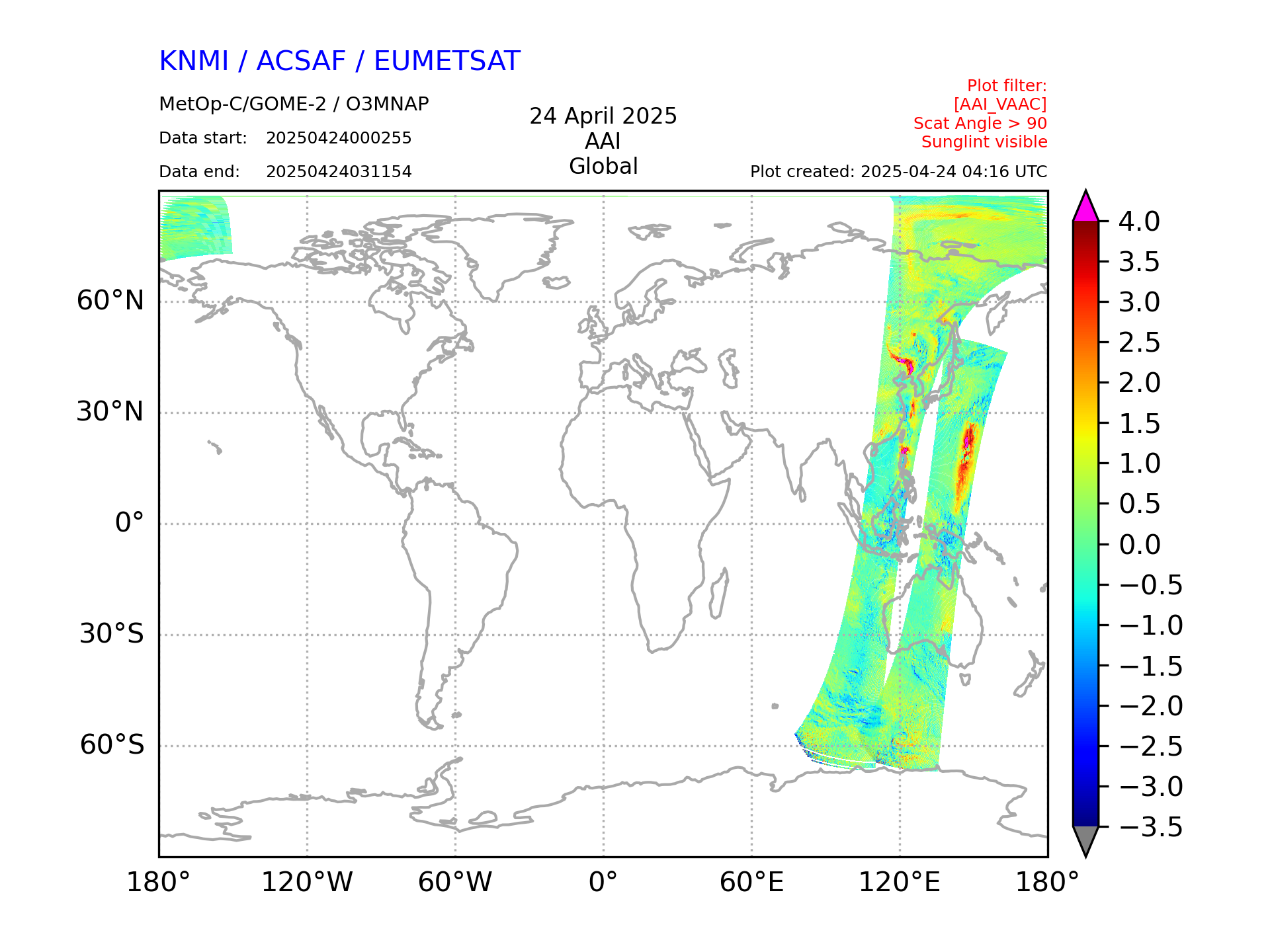
Near real-time Absorbing Aerosol Index from the Polarisation Measurement Detectors indicates the presence of elevated absorbing aerosols in the Earth's atmosphere. The aerosol types that are mostly seen are desert dust and aerosols from biomass burning and volcanic eruption events. Scattering Aerosol Index is reported as a negative residue in the product.
Type
Near real-time. Based on product requirements, the product files must be available to users in three hours from sensing.
Theoretical basis
Global Ozone Monitoring Experiment-2 (GOME-2) measures the radiance spectrum of sunlight scattered from the atmosphere. The product is derived from the reflectances measured by GOME-2 at 338 nm and 381 nm.
Processing algorithm
The AAI processor is integrated part of the AC SAF processing at KNMI. The algorithm calculates a ”residue” by using the contrast between the two wavelengths. When the surface albedo is assumed to be constant over the spectral range of the two selected wavelengths, and when the total ozone column is given, all deviations from a fully Rayleigh scattering atmosphere are assumed to be caused by absorbing aerosols. Note that scattering aerosols will be accounted for via an increased surface albedo. The total ozone column needed for the calculation is derived from the ozone climatology or sonde profile, which is selected by the user in the configuration file.
Units and spatial resolution
Absorbing aerosol index is a unitless linear scale, with higher values indicating elevated amount of aerosols present in the atmosphere. Spatial resolution of the product is equal to the spatial resolution of the small field-of-view PMD detector of the GOME-2 instrument: 5 km x 40 km for Metop-A and 10 km x 40 km for Metop-B.
Validation
This product is validated by KNMI. Validation is based on satellite-to-satellite comparison: GOME-2 AAI product is compared with OMI-TOMS (EOS Aura) and SCIAMACHY (Envisat) AAI products.
Dissemination
File format
This product is available in HDF5 format. Each file contains one PDU (Product Dissemination Unit), equal to three minutes of satellite data.
Algorithm version information
| Time period | GOME-2/Metop-A | GOME-2/Metop-B | GOME-2/Metop-C |
|---|---|---|---|
| until 15/07/2013 | 0.06 | N.A. | N.A. |
| 15/07/2013 - 23/02/2015 | 0.06 | 0.06 | N.A. |
| 23/02/2015 - 28/05/2015 | 0.07 | 0.07 | N.A. |
| 28/05/2015 - 16/11/2015 | 1.00 | 1.00 | N.A. |
| 16/11/2015 - 13/08/2018 | 1.01 | 1.01 | N.A. |
| 13/08/2018 - 19/11/2018 | 1.20 | 1.20 | N.A. |
| 19/11/2018 - 14/01/2019 | 1.30 | 1.30 | N.A. |
| 14/01/2019 - 31/01/2019 | 1.31 | 1.31 | N.A. |
| 01/02/2019 - 17/08/2020 | 1.32 | 1.32 | N.A. |
| 18/08/2020 - 19.05.2021 | 1.32 | 1.32 | 1.32 |
| 19/05/2021 - 15/11/2021 | 1.40 | 1.40 | 1.40 |
| 16/11/2021 - 29/04/2024 | N.A. | 1.40 | 1.40 |
| 30/04/2024 onwards | N.A. | 1.50 | 1.50 |
Important algorithm changes in 1.50
- Use of DLER v4
- Code updates due to compiler version updates
- Preparations for AAI version 3
- Adding SurfaceAlbedo, CloudHeight and Alpha to AAI output product
Documents
Composite image of the most recent near real-time absorbing aerosol index from PMDs from the Metop-C satellite (from TEMIS website)