Offline GOME-2 daily averaged (level 3) trace gas columns
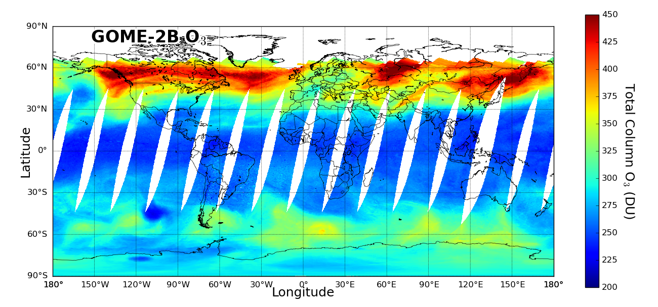
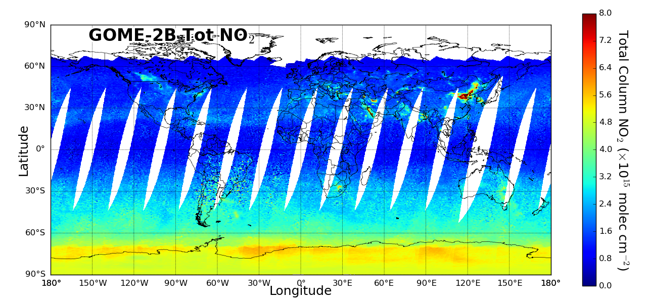
Example composite images of daily (15 Jan 2020) products
Description
The daily averaged (level 3) trace gas column products from GOME-2 provide information about the vertical column densities of O3, NO2 (total and tropospheric), HCHO, BrO, SO2 and H2O (TCWV) in the atmosphere.
Type
Offline. The product is available to users in 15 days from sensing. Typical delay is 2-3 days.
Satellites and instruments
GOME-2/Metop-B and GOME-2/Metop-C
Algorithm version
Level 3 gridding algorithm version 1.0 (based on GDP 4.8/4.9 GOME-2 Level 2 trace gas column products)
Theoretical basis
Level 3 gridding algorithm using area-weighted tessellation and cloud screening.
Processing
DLR produces daily gridded (averaged) O3, NO2 (total and tropospheric), HCHO, BrO, SO2 and H2O (TCWV) products based on the corresponding level 2 products generated with the GOME Data Processor (GDP) operational algorithm (only forward-scan pixels are used).
Units and spatial resolution
The trace gas column data are provided as vertical column densities with the following units: total O3 and SO2 columns in Dobson Units (DU), NO2, HCHO and BrO columns in molecules/cm2, and H2O columns in kg/m2. The spatial resolution is 0.25° x 0.25° (global coverage) and the temporal resolution is monthly (calendar).
Validation
The level 3 GOME-2 trace gas column products have been validated by RAL Space (RAL) in the framework of an AC SAF Associated Scientist project. The validation focused on the following aspects: (1) to verify the consistency between level 2 and 3 products, (2) to examine the consistency among the three GOME-2 sensors, and (3) to validate the level 3 products by comparing to ground-based observations.
Archiving and dissemination
These products are archived at the DLR and available via offline data access page.
File format
The products are delivered in NetCDF-4 format, each file containing daily averaged trace gas column data including error estimates (one trace gas per file), and additional cloud parameters and surface properties data.